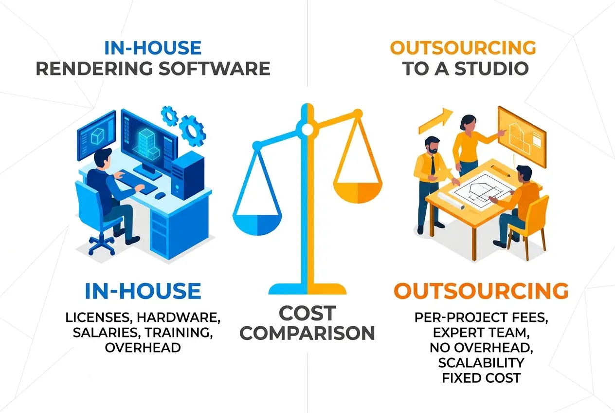

There’s a moment in every architectural rendering project where the building looks technically perfect — the façade is detailed, the materials read correctly, the lighting is dialled in — and yet something feels flat. The image doesn’t convince. It sits there looking like a 3D model rather than a building that will actually exist in a real place. That’s usually the moment when you realise context is missing. Why context matters in architectural rendering: how street-level surroundings and people make or break a development visual isn’t just a stylistic concern — it’s a structural one. Without it, the architecture floats in a visual vacuum, and no amount of material refinement will fix that.
We’ve worked on projects ranging from single-dwelling extensions to large mixed-use developments, and the pattern is consistent. The images that get the strongest responses from planning committees, investors, and buyers are almost never the ones with the most complex architecture. They’re the ones where the viewer instinctively understands the building in its place. They can feel the street. They can sense the scale. They can imagine themselves walking past it. That response is almost entirely driven by context — the surroundings, the people, the activity happening outside the building’s front door.
This post breaks down exactly how that works technically, where it goes wrong, and what a well-contextualised rendering actually requires to pull off convincingly.
Why Context Matters in Architectural Rendering: The Street-Level Perspective Changes Everything
Most clients think about renderings from above — or at least from a comfortable mid-distance. But the most persuasive views are almost always street-level, because that’s how humans actually experience buildings. A pedestrian eye height of roughly 1.6 to 1.7 metres changes everything about how a building reads. Scale becomes visceral. Ground-floor activation — retail frontage, entrance canopies, spill-out seating — becomes legible. And the relationship between the new building and what already exists on the street becomes honest and visible.
When we set up a street-level camera, we’re not just choosing an angle. We’re making a decision about what question we want the image to answer. “How does this building fit here?” is a completely different question from “What does the top of this building look like?” Planning officers, in our experience, care intensely about the first question. They want to know that the development responds to its context — that the grain, rhythm, and scale of the street are being respected, not ignored.
This is why aerial shots, while useful for masterplanning and site layout, rarely carry the emotional weight needed at planning submission or sales launch. They show the project’s footprint and massing. They don’t show what it’s like to stand outside it. If you’re thinking about which views to commission for your project, it’s worth reading our breakdown of how many renders do you actually need for a property development sales campaign a projecttype breakdown — because the mix of aerial, street-level, and detail views really does depend on what the image needs to communicate.
The Role of Existing Surroundings: Modelling What’s Already There
Getting the surroundings right is genuinely hard work, and it’s the area where corners get cut most often. A common shortcut is to place the proposed building against a simple ground plane with some generic trees and an approximate sky. It looks like a rendering. It doesn’t look like a place.
In our studio, we treat the context model as seriously as the proposal model. That means sourcing accurate data — OS mapping, Google Street View reference, LiDAR data where available, site photographs — and building the surrounding streetscape to a level of fidelity that makes the proposed building feel embedded rather than dropped in. We don’t need to model every detail of every neighbouring building. But we do need to get the massing right, the approximate materiality, the roofline rhythms, and the ground-level characteristics: pavement widths, tree canopy positions, road markings, parked cars.
The parked cars point is one that surprises clients sometimes. Streets without parked cars look sterile and unreal, especially residential ones. Adding a few contextually appropriate vehicles along the kerb does something subtle but important — it tells the viewer this is a lived-in place, not a show set.
For schemes where accurate context modelling is particularly critical — planning permission applications, for instance — the bar is even higher. Councils reviewing applications want to see honest massing in relation to neighbours, and any manipulation of surrounding building heights or positions will be noticed. Our post on exterior 3d rendering for planning permission what councils actually look for in visualisations covers the planning-specific requirements in more detail.
People, Scale, and Life: Why Human Figures Are Not Optional
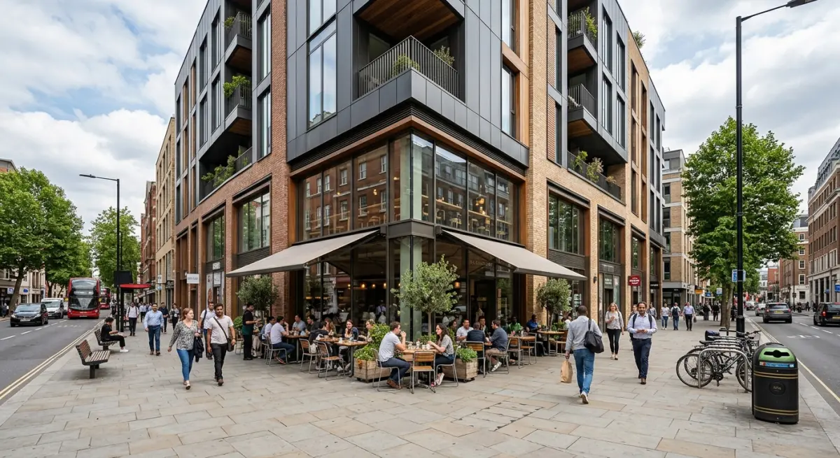
Human figures in renderings serve two functions that are easy to underestimate. The first is purely technical: scale. A building without people has no reliable scale reference. You can intellectually process the dimensions from a drawing, but in a rendered image, the eye needs bodies to understand size. Without them, a six-storey apartment building can read as a two-storey house, or vice versa.
The second function is emotional. People signal life. They tell the viewer that this is a place where things happen, where the building is being used and enjoyed. This is especially important for mixed-use, retail, and community-facing developments where activation of the ground floor is part of the scheme’s selling point.
The challenge is that badly placed or badly rendered people destroy an image faster than they help it. Stiff, floating, identically posed cutout figures look like clip art. We spend real time on figure selection and placement — choosing figures that match the demographic of the expected user group, adjusting scale carefully for each perspective, ensuring ground contact and shadow interaction are correct, and varying posture and direction to suggest natural movement rather than a staged photograph.
For schemes targeting specific audiences — later living developments, student accommodation, healthcare facilities — the demographic accuracy of the figures matters. A retirement village rendering populated with twenty-somethings gives the wrong message entirely. Similarly, the 3d rendering for later living and retirement developments how operators are marketing assisted living schemes offplan requires figures that reflect the actual community being marketed to.
Lighting, Time of Day, and the Atmosphere of Place
Context isn’t just physical — it’s atmospheric. The time of day you render at communicates something about the building’s character and use. A commercial office building rendered at the golden hour of a clear autumn afternoon looks aspirational. The same building rendered at the same time of year under overcast light looks more honest and contextually accurate for a planning submission in northern Europe.
Neither is wrong — they serve different purposes. But the choice needs to be deliberate. We’ve found that clients sometimes default to asking for “golden hour everything” without thinking about whether that’s what the image actually needs to communicate. For a planning submission, realistic mid-morning or overcast light is often more appropriate than a dramatic sunset that will raise eyebrows with planning officers who know the actual orientation of the site.
Sun and shadow are also context clues. The shadows cast by neighbouring buildings at a given time of day are part of the site’s reality. Accurate daylight simulation, as we cover in our post on daylight simulation in architectural rendering how accurate sun studies are helping developers beat planning objections, can be one of the most useful tools in a planning argument — because showing accurate solar data demonstrates that the proposed development was designed with its neighbours in mind.
Vegetation, Seasons, and Material Weathering
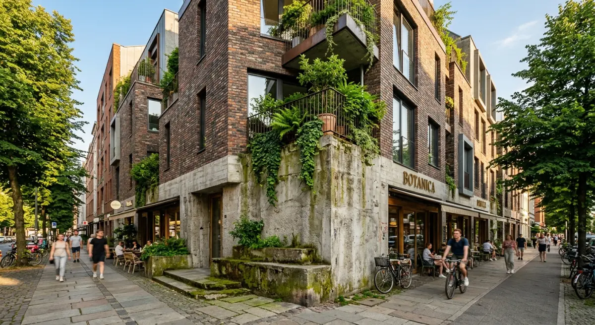
Trees are one of the most underrated elements in a development visual. A proposal that includes street trees, courtyard planting, or green roofs will look completely different depending on whether those trees are rendered in full summer leaf, in winter bare form, or at an early-establishment size rather than the mature canopy that the landscape scheme assumes.
The temptation is always to render trees at mature, full canopy — it looks better immediately. But if the planning submission shows trees that will take twenty years to reach that size, the image may set expectations that the development can’t deliver for decades. Getting the vegetation at an appropriate establishment size, with a note in the image legend, is both more honest and more defensible.
Material weathering is a smaller but similarly important point. New buildings don’t look like freshly rendered CGI forever. Some clients want to see the building looking clean and sharp on day one, which is valid for marketing. Others — particularly in heritage-sensitive areas — benefit from renderings that show how the materials will age and sit within their context over time. This is a conversation worth having early, because it affects material specification in the model.
What Clients Get Wrong: Common Context Mistakes
The most common mistake we see is treating context as an afterthought. The building gets modelled in detail, revisions go back and forth on the architecture, and then at the final stage someone says “can you add some trees and people?” Context doesn’t work that way. It needs to be planned from the brief stage — what surroundings will be modelled, what site reference material is available, what figures and landscape are appropriate, what time of day and weather condition best serves the purpose of each image.
The second mistake is mismatched quality between the building and the context. We’ve seen renders where the proposed building is detailed and sharp but the surrounding streets are blurry, low-poly, or obviously sourced from a stock background. The eye picks this up instantly. The building starts to look composited rather than located, which is exactly the opposite of what the image is supposed to achieve.
A third issue is inappropriate context for the audience. Marketing imagery for off-plan buyers can afford to be warmer, more aspirational, more populated with life. Planning submissions need to be accurate, honest representations of what will be built and how it will sit within its existing context. Using a sales-campaign rendering for a planning submission — and it does happen — tends to generate planning officer questions about whether the visual is a fair representation of the proposal.
| Context Element | Marketing Visual Priority | Planning Submission Priority |
|---|---|---|
| Surrounding building massing | Medium — background atmosphere | High — must be accurate |
| Human figures | High — aspirational, demographic-specific | Medium — scale reference only |
| Vegetation size | Mature canopy acceptable | Establishment size preferred |
| Lighting / time of day | Golden hour, warm and aspirational | Realistic, site-accurate solar angle |
| Street furniture / vehicles | Selective, visually clean | Accurate to existing street conditions |
| Material quality | Clean, day-one freshness | As-built accurate representation |
Large-Scale Schemes: When Context Becomes Even More Complex
On large developments — mixed-use blocks, masterplan schemes, or infrastructure-heavy proposals — managing context becomes significantly more involved. The development may interface with multiple different street typologies, existing buildings of varying character, and public realm that doesn’t yet exist. Each rendered view may require a different approach to context modelling depending on what it’s trying to show.
We’ve found that the most useful discipline in these cases is to define the views first — to agree on exactly what camera positions will be rendered before the context model is built, rather than building a generic context model and then discovering it doesn’t work for half the intended views. This is true whether the project is a residential scheme, a commercial office development, or something larger in scale. Even for industrial and infrastructure projects, where the contextual considerations are different in nature, the principle holds — understanding what the image needs to show determines how the context is built. If that subject interests you, our post on 3d rendering for data centre and industrial facility developments how developers present largescale infrastructure to institutional investors covers how context functions differently at infrastructure scale.
Conclusion: Context Is the Work, Not the Finishing Touch
A development visual isn’t a product shot. The building isn’t floating in a studio against a clean background — it exists somewhere, on a specific street, in a specific neighbourhood, at a specific scale relative to everything around it. The job of a contextualised rendering is to make that relationship visible and believable. When it works, the viewer stops seeing a CGI image and starts seeing a building. That shift in perception is what makes a rendering do its job.
Getting context right takes planning, reference material, and the discipline to treat the surroundings as seriously as the architecture. It’s not glamorous work, but it’s the work that separates a convincing image from one that just looks nice in isolation.
If you’re working on a development at any scale and want to discuss how to approach the contextual elements of your rendering brief, contact us at 360archviz.com — we’re happy to talk through what reference material you’ll need, how many views make sense for your project, and what the most effective approach to context modelling looks like for your specific scheme.
Frequently Asked Questions
Why do architectural renderings need people and street-level context to be effective?
Architectural renderings need people and street-level context because they help viewers understand scale, human experience, and how a building will feel to inhabit or pass by in real life. Without figures, landscaping, and surrounding streetscapes, a building can appear cold, disconnected, and unrealistic, making it harder for clients, planners, and the public to emotionally connect with the design. Studies in architectural visualization consistently show that contextual renderings are far more persuasive in planning approvals and investor presentations than isolated building shots.
How does adding surrounding buildings and neighborhood context improve an architectural rendering?
Adding surrounding buildings and neighborhood context grounds a development in reality, allowing stakeholders to see how the new structure will integrate with or contrast against its existing environment. This spatial accuracy helps identify potential issues like overshadowing, scale mismatches, or visual clutter before construction begins, saving costly design revisions later. A rendering that accurately reflects the streetscape also builds credibility with planning committees and local communities who are familiar with the area.
What types of people and human activity should be included in architectural renderings for maximum impact?
Effective architectural renderings should include a diverse mix of people engaged in realistic activities such as walking, cycling, sitting at outdoor cafes, or entering the building, tailored to the development's target demographic and purpose. For a retail development, busy pedestrian scenes signal commercial viability, while a residential rendering benefits from families, couples, and dog-walkers that evoke a sense of community and lifestyle. The key is ensuring the figures feel natural and purposeful rather than randomly placed, as poorly chosen or stiff-looking people can undermine an otherwise strong rendering.
Can poor contextual rendering actually hurt a planning application or development approval?
Yes, poor contextual rendering can significantly hurt a planning application because decision-makers may perceive the project as out of scale, incompatible with local character, or visually deceptive if the surrounding environment is misrepresented or omitted. Planning authorities in many jurisdictions are now specifically requesting accurate photomontages and verified viewpoints that demonstrate honest integration with the existing streetscape. A rendering that appears to hide neighboring buildings or inflate greenery to mask density can damage a developer's credibility and trigger objections from both planners and the public.
What is the difference between a photomontage and a standard architectural rendering, and which is better for showing street-level context?
A photomontage combines a photorealistic 3D rendering of a proposed building with an actual photograph of the existing site and surroundings, making it one of the most accurate and convincing ways to show how a development will look in its real-world context. A standard architectural rendering is typically a fully computer-generated image that may or may not accurately reflect surrounding conditions, depending on how much contextual data the artist incorporates. For planning applications, public consultations, and investor pitches where street-level accuracy is critical, a photomontage generally carries more credibility and persuasive power than a standalone rendering.