
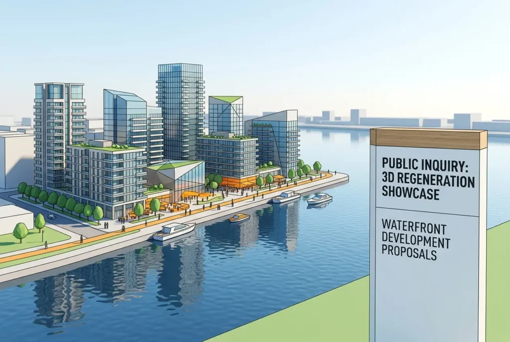
Waterfront regeneration schemes carry a kind of scrutiny that most other developments never face. You’ve got planning committees, flood risk consultants, heritage bodies, environmental groups, and often a very vocal public who remember what the site used to be — a working dock, a fishing harbour, an industrial quay — and have strong feelings about what it should become. When a scheme this contested heads toward public inquiry, the visuals you present stop being marketing collateral and start being evidence. That’s the real subject of this post: 3D Rendering for Mixed-Use Waterfront Developments: What Regeneration Schemes Need to Show Before Public Inquiry, and why the studios doing this well think less like artists and more like expert witnesses.
We’ve worked on enough regeneration briefs to know the pattern. A masterplan comes in with residential towers, retail frontage, a hotel block, maybe a marina or public promenade, and the client wants “a few nice hero shots” for the planning committee. That’s rarely enough. Public inquiries dig into flood levels, tidal context, massing against the existing skyline, pedestrian flow along the waterfront edge, and how the new buildings sit next to whatever heritage fabric survives on site. If your renders can’t answer those questions with precision, the inquiry will ask them anyway — just without visual support, which is a worse position to argue from.
This post is about what actually needs to be in the visual package, not just what looks good in a brochure. There’s a real difference between rendering to sell apartments and rendering to survive cross-examination from a planning inspector.
Why Waterfront Regeneration Schemes Face a Different Bar at Public Inquiry
Public inquiry is triggered when a scheme is either called in by the Secretary of State, contested through appeal, or large enough to warrant formal examination beyond the usual committee vote. Waterfront sites end up here more often than inland ones because they intersect with so many additional layers of regulation — Environment Agency flood zones, navigation authorities, sometimes marine licensing, and heritage designations tied to old harbour walls, listed warehouses, or scheduled monuments nearby.
An inspector examining this kind of scheme isn’t just looking at whether the architecture is attractive. They’re testing claims: Does this development harm the setting of a listed structure? Does it block established view corridors to the water? Does the massing overshadow public open space at certain times of year? Every one of these is a visual question at heart, which means every one of these is something your rendering package needs to address directly rather than imply.
The Core Views Every Waterfront Scheme Needs Before Inquiry
Over the years we’ve settled on a rough hierarchy of views that regeneration schemes almost always need, regardless of site specifics.
- Long-range approach views — from the opposite bank, from a bridge, from the main road approach. These establish how the development reads in the wider landscape, not just from close up.
- Skyline and massing studies — usually wireframe or greyscale overlays against the existing skyline, showing height and bulk without the distraction of material finishes. Inspectors trust these because they’re not “pretty,” they’re diagrammatic.
- Waterline and tidal context shots — showing the development at both high and low tide if the site has significant tidal range, because flood risk assessors and the Environment Agency will ask about it regardless.
- Street-level and public realm views — pedestrian eye height, showing how the promenade, public seating, and ground floor retail actually feel to walk through, not just how the towers look from a drone.
- Heritage context views — sightlines from and toward any listed or locally significant structures on or near the site.
Missing any one of these leaves a gap that objectors or the inspector will fill with their own assumptions, and those assumptions are rarely generous.
Massing Accuracy Matters More Than Material Finish

This is the point we push back on hardest when clients ask us to “make it look finished” too early. At inquiry stage, a beautifully rendered facade with the wrong massing is worse than a plain grey block with the right massing, because the first thing an inspector or an objecting barrister will do is check your renders against the submitted drawings. If the visual makes the building look shorter, slimmer, or set back further than the actual planning drawings show, that discrepancy gets flagged immediately and it damages the credibility of everything else in your submission.
We always cross-check camera positions, lens focal length, and building heights against the architect’s model before touching lighting or materials. Getting this alignment right is genuinely more important than the render looking beautiful. You can read more about how we think through this kind of accuracy versus polish trade-off in our piece on what level of architectural detail do you actually need in a 3d rendering LOD 100 to LOD 400 explained for developers, because waterfront schemes often need different LOD treatment for the tower blocks versus the ground floor public realm.
Flood Risk, Daylight, and Overshadowing — Visualising the Technical Objections
Waterfront sites almost always attract objections around flood risk and daylight, and both are things a good render can address directly rather than leaving to a written report nobody reads in full.
For flood risk, we build tidal markers into the CGI itself — showing the development against modelled flood levels, sometimes with a simple water-level line overlaid on the elevation. It sounds basic, but inspectors respond well to visuals that make an abstract number (a flood level in metres above datum) into something they can see against a real building elevation.
For daylight and overshadowing, accurate sun studies are non-negotiable. We use proper geo-located sun positioning tied to the site’s actual latitude and the time of year in question, not a generic “golden hour” setup that looks nice but proves nothing. Our piece on daylight simulation in architectural rendering how accurate sun studies are helping developers beat planning objections goes into how this works in practice — the short version is that a sun study run at the wrong time of year is worse than no sun study at all, because it invites objectors to challenge your methodology instead of your architecture.
Context Is the Argument, Not the Backdrop

On inland urban schemes, context is often treated as decoration — trees, cars, a bit of street furniture to stop the render looking sterile. On waterfront regeneration, context is the argument. The water itself, the existing quay walls, the boats, the tidal mudflats, the neighbouring industrial heritage — all of it needs to be modelled or photomontaged with real care because objectors will be looking specifically at how the new scheme relates to what’s already there.
This is where the decision between drone photomontage and fully modeled 3D environments actually matters at a technical level, not just a budget level. Our comparison on drone photomontage CGI vs fully 3D modeled environments which context option fits your development planning budget is worth reading here — for a phased regeneration scheme where the surrounding context will change over ten or fifteen years, a fully modeled environment usually holds up better under repeated inquiry sessions than a photomontage tied to a single day’s drone capture.
If there’s a listed building or scheduled structure on or near the waterfront — an old crane, a warehouse, a harbourmaster’s office — the same logic we use for conservation-sensitive extensions applies. Our guide on 3D rendering for Grade II listed buildings how to visualize modern extensions for conservation officer approval covers the visual language that heritage officers respond to, and a lot of it transfers directly to waterfront heritage assets.
Masterplan Scale and Aerial Views for Committee Understanding
Most waterfront regeneration schemes are phased masterplans, not single buildings, and inquiries need to understand the whole site, not just phase one. Aerial and bird’s-eye views showing the full masterplan extent, including future phases, help inspectors and objectors see how the scheme fits together over time rather than judging phase one in isolation.
We’ve found aerial renders work particularly well for this because they show public realm connectivity — how the promenade links to the town centre, how green corridors connect to existing parks — in a way that ground-level shots simply can’t. Our comparison piece on aerial rendering vs site plan drawings what mixed-use developers are using to get schemes approved faster is directly relevant if you’re deciding how much weight to put on aerial views versus traditional 2D site plans in your submission. And if the scheme includes significant landscaping or public green infrastructure along the waterfront edge, it’s worth looking at how landscape architects use 3D exterior renderings to communicate green infrastructure to planning committees, since waterfront public realm is judged on planting maturity and usability just as heavily as the buildings themselves. For the wider masterplan context, our guide on 3D rendering for masterplan developments how urban designers present large-scale mixed-use sites to local authorities covers a lot of the same ground.
What We See Clients Get Wrong
The most common mistake is commissioning renders too late, after the architectural drawings are already fixed and the inquiry date is close. Massing studies and daylight analysis need to happen early enough that if the visuals reveal a problem — overshadowing a public square, blocking a heritage sightline — there’s still time to adjust the design, not just the presentation.
The second mistake is over-polishing. Public inquiry audiences include planning inspectors who’ve seen hundreds of renders and can smell an oversold visual from across the room. Photorealistic glamour shots with dramatic sunset lighting and no people in frame read as marketing, not evidence. We generally recommend a mixed pack — a handful of accurate, slightly restrained daytime views for the technical submission, alongside more expressive marketing visuals kept separate for public exhibition boards or the project website.
Third, people forget that public inquiries often run over multiple sessions, sometimes months apart. If your visuals go out early and get challenged, you need the ability to revise specific views quickly without re-rendering the whole package. Working with a studio that keeps the 3D scene file organised and reusable, rather than a one-off render job, saves real time here.
Bringing It Together
Getting a waterfront regeneration scheme through public inquiry isn’t about producing the most beautiful visuals in the room. It’s about producing the most defensible ones — massing that matches the drawings, daylight studies tied to real sun positions, flood context that’s honest about tidal risk, and enough contextual accuracy that nobody can credibly claim you’ve hidden something. That takes a studio that understands planning process as much as it understands rendering software.
If you’re preparing a waterfront or mixed-use regeneration scheme for public inquiry, it’s worth talking to a team that’s built this kind of technical visual evidence before rather than treating it as an afterthought to the marketing package. Get in touch through our contact us page and we can walk through what your specific scheme needs before the submission deadline gets close.
Frequently Asked Questions
What level of detail should 3D renderings show for a waterfront regeneration scheme going to public inquiry?
Renderings need to demonstrate accurate massing, materials, and scale relative to existing waterfront context, including tidal flood lines and public realm interfaces. Planning inspectors typically expect verified sightline studies and true-to-scale human figures to assess overshadowing and visual impact. Generic or stylised visuals without technical accuracy can undermine credibility during cross-examination.
How do you visualize flood risk and tidal changes in waterfront development renderings?
Effective visualizations overlay flood zone data, tidal range markers, and predicted sea-level scenarios directly onto the 3D model at different times of day and tide states. This often includes before/after comparisons showing flood defences, raised podiums, or SuDS features integrated into the landscape design. Inquiry panels specifically look for evidence that flood mitigation isn't just technically described but visibly demonstrated within the massing and ground-level detailing.
What's the difference between marketing CGI and evidential 3D renderings for planning inquiries?
Marketing CGI prioritizes aesthetic appeal with idealized lighting, staged scenes, and selective viewpoints, while evidential renderings must be verified against survey data, camera positions, and lens specifications for accuracy. Inquiry-grade visuals require a Verified View methodology with fixed reference points and metadata that can withstand scrutiny from objectors' expert witnesses. Using marketing-style CGI as evidence often triggers challenges to credibility and can delay proceedings.
How should mixed-use waterfront schemes show pedestrian and public access in 3D renderings?
Renderings should depict continuous waterfront walkways, access points, and public open spaces populated with realistic pedestrian activity at varying times of day and tide conditions. This includes demonstrating step-free access, seating areas, and connections to existing public rights of way that inquiry panels assess against policy requirements for public benefit. Static, empty renders that omit human activity often raise questions about genuine public accessibility claims.
What viewpoints and angles are essential for waterfront regeneration renderings at public inquiry?
Essential viewpoints include views from the opposite bank or waterway, key public vantage points identified in local landscape character assessments, and street-level views showing the development's relationship to existing heritage or townscape. Aerial views showing the wider masterplan context and cumulative impact with neighboring developments are also typically required. These viewpoints should match those used in the Environmental Statement's Landscape and Visual Impact Assessment to ensure consistency across the evidence base.


