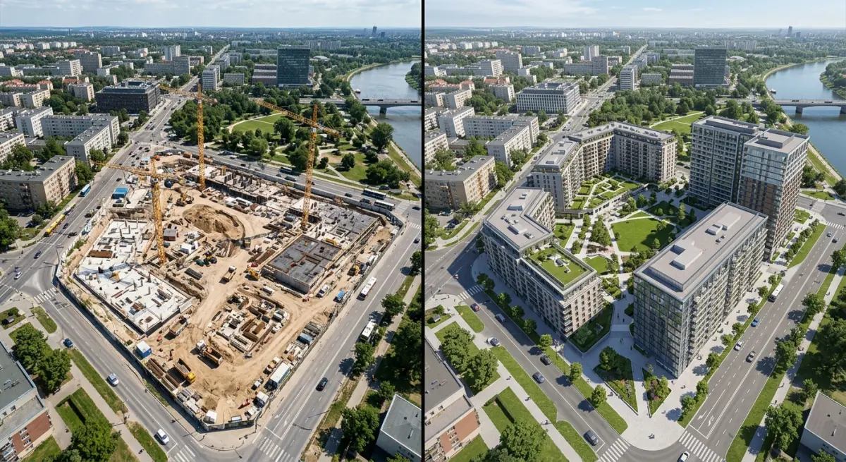
Planning applications have always been a communication challenge as much as a technical one. You’re asking a planning committee — often made up of people who can’t read architectural drawings the way a trained architect can — to approve something that doesn’t exist yet. The gap between what an architect imagines and what a committee member visualises is where approvals get delayed, rejected, or watered down. Aerial 3D Rendering for Planning Applications: How Drone-Style Visualisations Are Changing Development Approvals has become one of the most discussed topics in our studio over the past couple of years, and for good reason. When you show a planning officer a bird’s-eye rendered view of a proposed development sitting within its actual neighbourhood context, the conversation shifts entirely. They’re no longer guessing. They’re seeing.
Traditional elevation drawings and street-level renders still have their place, but they only tell part of the story. A six-storey residential block might look perfectly reasonable in a street-level render — until you see it from above and realise it completely overwhelms the single-storey terrace behind it. Aerial views expose that relationship immediately. For planning committees, that context is everything. It’s also why developers who invest in proper aerial visualisations tend to go into planning hearings with more confidence. Not because the renders are prettier, but because they’re doing a better job of pre-answering the committee’s hardest questions.
We’ve worked on planning applications across the UK, Middle East, and Southeast Asia, and the pattern is consistent. Projects submitted with well-composed aerial renders generate fewer objections, fewer requests for additional information, and cleaner approval routes. That’s not magic — it’s just better communication.
What Aerial 3D Rendering for Planning Applications Actually Involves
There’s a common misconception that aerial renders are just regular exterior renders shot from a higher camera angle. They’re not. A proper aerial 3D rendering for planning purposes requires a fundamentally different approach to scene construction, site modelling, and contextual accuracy.
Here’s what’s actually involved:
- Site survey data or OS mapping: We work from OS (Ordnance Survey) maps, LiDAR data, or drone photogrammetry of the actual site to build accurate terrain and surrounding building masses. Inventing the neighbourhood won’t pass a planning committee.
- Surrounding context modelling: We model the adjacent streets, existing buildings, green spaces, roads, and infrastructure at a level of detail appropriate to the viewing distance. The proposed development gets full detail; the surrounding context gets simplified but accurate massing.
- Camera positioning: The camera height and angle need to be deliberately chosen based on what the planning application needs to prove — proximity to listed buildings, impact on green belt, roofscape quality, relationship to transport links. Different angles serve different arguments.
- Lighting and atmosphere: Daytime renders with neutral, even lighting are standard for planning submissions. Some applications also benefit from dusk renders or seasonal variations to address specific concerns around shadowing or amenity.
Understanding what makes a commercial exterior rendering look photorealistic — lighting, materials, and context explained — applies directly here. The principles of accurate atmospheric scattering, material reflectance, and contextual truthfulness are just as critical when the camera is 200 metres in the air.
Why Planning Committees Respond Better to Aerial Views
Planning committees are not architects. Some members are local councillors, community representatives, or business owners. They’re intelligent people making important decisions, but they’re doing it without technical training in spatial reasoning. A floor plan or a CAD section means very little to them. An aerial render showing the proposed building inside the actual neighbourhood — with recognisable landmarks, streets, and adjacent properties visible — gives them an immediate, intuitive read on scale and impact.
There’s also a credibility dimension. An aerial render that matches Google Earth or a known aerial photograph of the site signals to the committee that the applicant isn’t hiding anything. When the surrounding context looks accurate and familiar, the proposed building sits within it more convincingly. Conversely, aerial renders that show a suspiciously sparse or idealised context around the development tend to attract scepticism. Committees notice when the surrounding streets look too clean or when neighbouring buildings are conveniently shorter than they actually are.
This connects directly to what exterior 3D rendering for planning permission — what councils actually look for in visualisations — means in practice. Accuracy and contextual honesty are more persuasive than polish. A gorgeous render of a building surrounded by inaccurate context will undermine trust faster than a technically simpler render that gets the neighbourhood right.
Drone-Style vs True Aerial: What’s the Difference and Does It Matter?
The term “drone-style” is worth unpacking. In 3D rendering, it refers to camera angles that mimic the perspective of a commercial drone — typically between 30 and 80 metres altitude, with a moderate downward tilt. This gives you that recognisable, slightly oblique aerial view that’s become familiar from real estate photography and property marketing. It shows roofline, building façade, surrounding streets, and green space in a single frame.
True aerial rendering — straight-down or near-vertical — is less common in planning applications but comes into play for masterplan submissions, large-scale infrastructure projects, or when you need to demonstrate site coverage and landscaping ratios clearly. The difference matters because they serve different purposes:
| View Type | Best Used For | Key Advantage |
|---|---|---|
| Drone-style oblique (30–80m) | Residential developments, mixed-use schemes, heritage settings | Shows massing, façade character, and street relationship simultaneously |
| High oblique (200–500m simulated) | Larger masterplans, urban extensions, transport infrastructure | Contextualises the scheme within a wider area |
| True vertical / ortho | Site coverage, landscaping plans, masterplan overviews | Clear, measurable representation of footprint and layout |
| Flythrough animation | Public consultations, appeals, high-profile schemes | Guides the viewer through the site and its surroundings dynamically |
For animation-based submissions, 3D walkthrough vs 3D flythrough — which presentation format wins more real estate approvals — is a question worth thinking through carefully. Flythroughs are generally more appropriate for planning and public consultation; walkthroughs suit marketing. The distinction affects how you script and deliver the animation.
What Actually Works: Observations from Planning Submissions We’ve Supported
A few things we’ve noticed consistently when working on planning visualisations:
Multiple aerial angles beat a single hero shot. One perfect aerial view leaves committees wanting to see the other side, the back of the building, or the relationship to a specific neighbouring property. Providing three to five carefully chosen aerial angles pre-empts those requests and shows the applicant has nothing to conceal.
Seasonal context matters more than people think. A development near mature trees looks very different in summer (full canopy, natural screening) versus winter (bare branches, reduced screening). Planning officers increasingly ask for both. Building it into the brief from the start is cheaper than retrofitting it later.
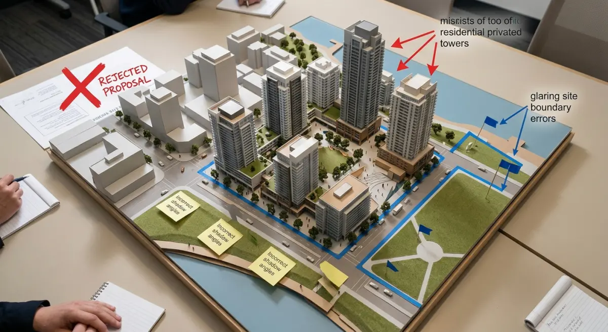
The surrounding buildings need to be right. We’ve seen applications undermined because a planning officer happened to know the area and spotted that a neighbouring building had been shown at the wrong height. Spending time getting the context model accurate is not optional — it’s the foundation on which the whole submission’s credibility rests.
Photomontage composites have their own rules. When aerial renders are composited onto actual aerial photography of the site, there are specific technical standards (particularly in the UK, where the Accurate Visual Representation guidelines apply) around camera matching, lighting consistency, and declared tolerances. These aren’t optional extras — a submission that doesn’t meet them can be rejected on technical grounds alone.
If you’re working with an offshore studio for cost reasons, make sure they understand local planning standards — not just rendering quality. We’ve written previously about onshore vs offshore architectural rendering studios — what developers are actually giving up on price — and planning submissions are one of the contexts where local knowledge genuinely affects output quality.
Common Mistakes That Cost Developers Time and Money
The most expensive mistake is commissioning aerial renders too late in the process. We get calls from developers who are days away from a planning submission and want aerial visuals turned around in 48 hours. It’s sometimes possible, but the results suffer and the cost goes up. Aerial renders need time — for site modelling, for accuracy checking, for revisions based on feedback from the architect and planning consultant.
The second most common mistake is under-briefing the studio. An aerial render for planning is not the same as one for marketing. The studio needs to know: What is the planning authority specifically asking for? Are there sensitive neighbours or heritage assets that need to appear in frame? Is this going to a public consultation or a committee? Will it be composited onto aerial photography? These questions shape everything from camera angles to lighting to context model detail. A well-prepared brief is the single biggest factor in getting useful output on the first round of revisions. How to brief a 3D rendering studio — what architects and developers need to prepare before project kickoff — walks through exactly what that preparation looks like.
Third: treating aerial renders as a tick-box exercise. The committees and planning officers who review these submissions are looking at them carefully. A render that’s technically present but doesn’t actually address the planning concerns — overshadowing, bulk, heritage impact — isn’t doing its job. The visualisation needs to be built around the planning argument, not just attached to the application as an afterthought.
The Broader Role of Visualisation in the Planning Process
Aerial renders don’t exist in isolation. They’re most effective when they’re part of a coordinated visualisation strategy that includes street-level exterior renders, site plans, and — for larger schemes — public consultation materials. A 3D walkthrough vs 3D flythrough decision, for instance, might be made based on whether the application includes a public exhibition or goes straight to committee. Some developers also commission 3D 360 virtual tour rendering for public consultations, allowing local residents to explore a proposed scheme interactively — which can significantly reduce formal objections by giving people a genuine sense of what’s being proposed.
It’s also worth noting that the visualisation assets produced for planning don’t go to waste after approval. The same site model and aerial camera setups that serve a planning submission can be adapted for investor presentations, marketing materials, and pre-sales. Developers who think about the full lifecycle of their visualisation assets from the start get considerably more value from the investment.
If you’re preparing for a planning application and want to discuss the right visualisation approach for your project, contact us at 360archviz.com. We work with architects, planning consultants, and developers at all project scales, and we understand what planning authorities actually need to see — not just what looks impressive.
Frequently Asked Questions
What is aerial 3D rendering for planning applications and how does it differ from traditional architectural drawings?
Aerial 3D rendering for planning applications involves creating photorealistic, drone-style visualisations that show a proposed development from above within its real surrounding environment, using CGI technology rather than an actual drone. Unlike traditional 2D floor plans or basic elevations, these renders allow planning officers, councillors, and local communities to fully understand how a building will sit within its context, including its relationship to neighbouring properties, streetscapes, and green spaces. This immersive perspective significantly reduces misinterpretation of proposals and helps stakeholders make more informed decisions during the approval process.
Can aerial 3D visualisations actually improve the chances of getting planning permission approved?
Yes, high-quality aerial 3D visualisations can positively influence planning outcomes by giving decision-makers a clear, unambiguous understanding of a scheme's scale, massing, and visual impact before construction begins. Planning committees are more likely to support applications that demonstrate transparency and community consideration, and photorealistic renders help address common objections around overlooking, overshadowing, and neighbourhood character proactively. Many architects and developers report fewer revision requests and faster approvals when professional aerial CGIs are included as part of a well-prepared planning submission.
How much does aerial 3D rendering for a planning application typically cost in the UK?
The cost of aerial 3D rendering for UK planning applications generally ranges from £800 to £5,000 or more depending on the complexity of the development, the level of photorealism required, and the number of viewpoints needed. Smaller residential projects such as extensions or new-build homes tend to sit at the lower end of the scale, while large commercial, mixed-use, or urban regeneration schemes command higher fees due to the detailed modelling and contextual integration involved. Investing in quality visualisation is often cost-effective when weighed against the potential delays and costs associated with refused or repeatedly revised applications.
What information does a CGI studio need to produce aerial 3D renders for a planning submission?
To produce accurate aerial 3D renders for a planning application, a CGI studio typically requires architectural drawings including site plans, floor plans, elevations, and section drawings, along with any available 3D CAD or BIM files. Contextual information such as Ordnance Survey data, site photographs, and details about surrounding buildings, landscaping, and materials helps the studio accurately integrate the proposed development into its real environment. The more complete and detailed the brief, the more precise and planning-ready the final visualisations will be, reducing the likelihood of costly amendments.
Are drone-style CGI renders accepted as supporting documents by UK local planning authorities?
Yes, photorealistic aerial 3D CGI renders are widely accepted and increasingly encouraged by UK local planning authorities as supporting visual documents within a planning application. They are particularly valued in Design and Access Statements and Visual Impact Assessments, where demonstrating a proposal's relationship to its surroundings is essential. While they are not a statutory requirement for all applications, major developments, heritage settings, and green belt sites especially benefit from aerial visualisations, as they directly address the planning policies and visual sensitivity considerations that officers must assess.